BENEATH THE BLUE

ONE of the most famous navigators to explore WA was Frenchman Louis de Freycinet (1779-1841) who not only circumnavigated the earth, but in 1811 published the first map to show a full outline of the Australian coastline. He spent a lot of time around southern WA, collecting botanical specimens and exploring the inlets and coastal areas. Standing on Lights Beach in William Bay NP on the last day of our Bibbulmun walk I could imagine Louis de Freycinet staring at this peaceful bay from his ship Uranie sharing this magnificent view with one special person he managed to sneak on board...
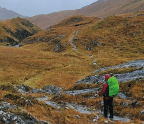
William Bay NP is one of many highlights on the Bibbulmun Track and if you had the time to walk all 1000km you’d see the lot. But for most of us time-poor travellers one of the best ways to get a taste of this long-distance walking trail is with a tour operator who’ll show you the highlights.

“AFTER THE WALK WE VISITED ONE OF THE MANY BOUTIQUE VINEYARDS THE AREA IS FAMOUS FOR.”